
FR · EN
18.589 N · 16.102 W
Tanit
A right-hand point break over sand created by the fishing port, built in 2018. It works from 1.8 m of swell, on eight years of imagery.
A right-hand point break over sand created by the fishing port, built in 2018. It works from 1.8 m of swell, on eight years of imagery.
Confirmed: the wave shows up in the same place over several years of satellite images, in big swell. That tells us it works, not yet how good it is at the peak.
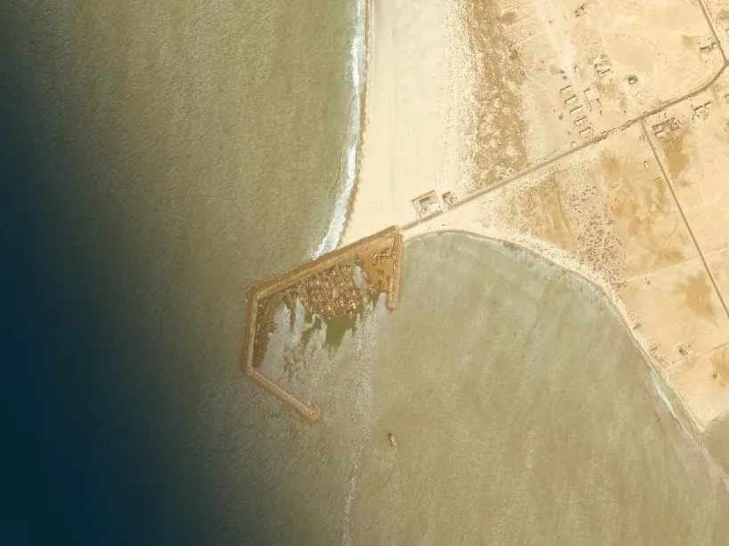
Each archive year brings together images taken on different dates depending on the place: they do not all show the same swell.