
FR · EN
20.825 N · 17.093 W
Lagouira
Right-hander below the old fort. In big north-west swell, the waves wrap around the point and peel into the sandy cove.
Right-hander below the old fort. In big north-west swell, the waves wrap around the point and peel into the sandy cove.
Atlantic side of the peninsula, Western Sahara side: military zone, access by permit only, mines reported.
Confirmed: the wave shows up in the same place over several years of satellite images, in big swell. That tells us it works, not yet how good it is at the peak.
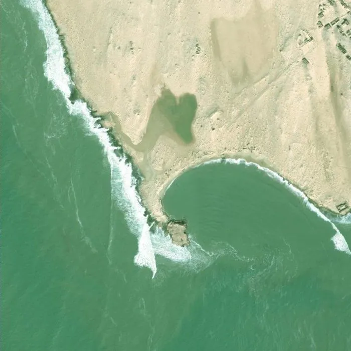
Each archive year brings together images taken on different dates depending on the place: they do not all show the same swell.